Category:Yakima River
Jump to navigation
Jump to search
tributary to the Columbia River in Washington state, United States of America   | |||||
| Upload media | |||||
| Instance of | |||||
|---|---|---|---|---|---|
| Location |
| ||||
| Length |
| ||||
| Elevation above sea level |
| ||||
| Origin of the watercourse | |||||
| Mouth of the watercourse | |||||
| Drainage basin | |||||
| Tributary |
| ||||
 | |||||
Subcategories
This category has the following 13 subcategories, out of 13 total.
A
B
- Big Pines Recreation Site (25 F)
E
- Easton Diversion Dam (1 F)
K
N
P
- Prosser Diversion Dam (2 F)
R
- Roza Dam (2 F)
S
- Sunnyside Canal (4 F)
- Sunnyside Diversion Dam (3 F)
T
W
- Wapato Diversion Dam (8 F)
Y
Media in category "Yakima River"
The following 82 files are in this category, out of 82 total.
-
 YakimaRiverWatersjed.png 841 × 596; 25 KB
-
 A bend in the river beside the Yakima Greenway, in Union Gap, Washington - panoramio.jpg 2,592 × 1,552; 616 KB
-
 A convention of hotair balloonists, a party in the sky.jpg 4,288 × 2,848; 1.06 MB
-
 Bighorn-sheep--yakima-river-canyon 8682856576 o.png 1,576 × 2,800; 6.07 MB
-
 Cle Elum River mouth.jpg 4,032 × 3,024; 3.11 MB
-
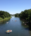
 Double inflatable kayak on the Yakima River, Washington.jpg 1,536 × 1,024; 441 KB
-
Drone video above Yakima River Canyon.webm 35 s, 1,920 × 1,080; 72.97 MB
-
Explore Washington Recreation- Yakima River Corridor.webm 1 min 9 s, 1,920 × 1,080; 72.68 MB
-
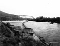
 Footbridge 3984.JPG 4,272 × 2,848; 6.81 MB
-
-
 Hot air balloon event in Prosser, Washington.jpg 4,288 × 2,848; 5.77 MB
-
 Lmuma Creek Recreation Site (32400426493).jpg 4,422 × 3,317; 6.6 MB
-
 Lmuma Creek Recreation Site (33058657382).jpg 4,672 × 2,928; 6.65 MB
-
 Lmuma Creek Recreation Site (33087415881).jpg 4,380 × 2,988; 6.8 MB
-
 Rafters enjoying a summer day on the Yakima below Horn Rapids (1).png 2,247 × 2,614; 8.01 MB
-
 Rafters enjoying a summer day on the Yakima below Horn Rapids.JPG 2,247 × 2,614; 1.82 MB
-
 Roza Recreation Site (32372124284).jpg 4,776 × 3,384; 8.61 MB
-
 Roza Recreation Site (32372124714).jpg 2,892 × 2,044; 3.3 MB
-
 Roza Recreation Site (32372125134).jpg 4,432 × 3,056; 6 MB
-
 Roza Recreation Site (32372125634).jpg 4,741 × 3,556; 9.12 MB
-
 Roza Recreation Site (32372126034).jpg 3,264 × 2,448; 4.11 MB
-
 Roza Recreation Site (32372126094).jpg 2,492 × 1,424; 2.88 MB
-
 Roza Recreation Site (32372126374).jpg 4,782 × 3,586; 11.7 MB
-
 Roza Recreation Site (32372126494).jpg 4,896 × 2,832; 7.38 MB
-
 Roza Recreation Site (32401558183).jpg 4,896 × 3,672; 9.08 MB
-
 Roza Recreation Site (32401558523).jpg 4,304 × 3,232; 7.92 MB
-
 Roza Recreation Site (32833675970).jpg 4,536 × 3,672; 7.83 MB
-
 Roza Recreation Site (32833676400).jpg 4,624 × 2,800; 6.13 MB
-
 Roza Recreation Site (32833676820).jpg 3,480 × 2,600; 4.4 MB
-
 Roza Recreation Site (32833677380).jpg 4,896 × 3,672; 7.92 MB
-
 Roza Recreation Site (32833678240).jpg 4,480 × 3,176; 8.09 MB
-
 Roza Recreation Site (33088482971).jpg 4,896 × 3,672; 8.26 MB
-
 Roza Recreation Site (33088483501).jpg 3,876 × 2,610; 5.94 MB
-
 Sarg Hubbard Park - panoramio (2).jpg 9,110 × 1,993; 13.08 MB
-
 Sarg Hubbard Park - panoramio (4).jpg 3,264 × 2,448; 1.72 MB
-
 Sarg Hubbard Park - panoramio (5).jpg 2,981 × 1,076; 646 KB
-
 Sarg Hubbard Park - panoramio (7).jpg 10,961 × 2,089; 16.04 MB
-

-
 Snow and ice in the Yakima River Canyon (32032911420).jpg 4,608 × 3,456; 3.79 MB
-
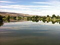
 The Yakima River.jpg 1,200 × 800; 1.17 MB
-
 Upper Yakima River from Highway 10, between Cle Elum and Thorp, Washington.jpg 3,264 × 2,448; 3.22 MB
-
 Van Giesen Street Bridge over the Yakima River 1.jpg 3,264 × 2,448; 1.83 MB
-
 Van Giesen Street Bridge over the Yakima River 2.jpg 3,264 × 2,448; 2.1 MB
-
 Van Giesen Street Bridge over the Yakima River 3.jpg 3,264 × 2,448; 1.98 MB
-
 Van Giesen Street Bridge over the Yakima River 4.jpg 3,264 × 2,448; 1.8 MB
-
 Van Giesen Street Bridge over the Yakima River 5.jpg 3,264 × 2,448; 1.73 MB
-
 Van Giesen Street Bridge over the Yakima River 6.jpg 3,264 × 2,448; 1.69 MB
-
 Van Giesen Street Bridge over the Yakima River 7.jpg 3,264 × 2,448; 1.71 MB
-
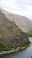
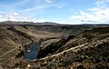
 View north from Umtanum Ridge into Yakima Canyon 0960.jpg 1,788 × 1,192; 506 KB
-
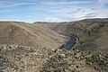
 View south from Umptanum Ridge into Yakima Canyon 0961.jpg 1,501 × 949; 355 KB
-
 WA 821.jpg 5,184 × 3,456; 7.31 MB
-
 Wannawish Dam.jpg 1,000 × 534; 127 KB
-
 WASR10 YakimaRiver.jpg 1,638 × 1,200; 405 KB
-
 Yakama Indian Reservation in Washington state (Openstreetmap).png 1,778 × 1,212; 993 KB
-
 Yakima Delta Habitat Management Unit.jpeg 4,032 × 3,024; 2.35 MB
-
 Yakima Greenway - panoramio (11).jpg 1,552 × 2,592; 652 KB
-
 Yakima Greenway - panoramio (29).jpg 5,438 × 1,972; 6.94 MB
-
 Yakima Greenway - panoramio (30).jpg 4,258 × 2,052; 6.26 MB
-
 Yakima Greenway - panoramio (31).jpg 3,354 × 1,209; 3.08 MB
-
 Yakima Greenway - panoramio (32).jpg 3,264 × 2,448; 1.83 MB
-
 Yakima Greenway - panoramio (33).jpg 3,264 × 1,143; 878 KB
-
 Yakima Greenway - panoramio (36).jpg 3,264 × 2,448; 2.01 MB
-
 Yakima Greenway - panoramio (37).jpg 3,264 × 2,448; 1.64 MB
-
 Yakima Greenway - panoramio (39).jpg 3,264 × 2,448; 1.69 MB
-
 Yakima Greenway - panoramio (44).jpg 5,464 × 2,005; 7.5 MB
-
 Yakima Greenway - panoramio (8).jpg 3,648 × 2,736; 3.54 MB
-
 Yakima River at Prosser.jpeg 3,024 × 4,032; 3.69 MB
-

-
Yakima River Canyon (1).webm 15 s, 1,920 × 1,080; 31.82 MB
-
Yakima River Canyon (3).webm 5.2 s, 1,920 × 1,080; 13.71 MB
-
 Yakima River Canyon (30692979635).jpg 2,550 × 3,300; 2.06 MB
-
 Yakima River Canyon - 26718232170.jpg 8,838 × 2,968; 16.33 MB
-
Yakima River Canyon 20160512.webm 17 s, 1,920 × 1,080; 25.87 MB
-
Yakima River Canyon.webm 5.2 s, 1,920 × 1,080; 13.71 MB
-
 Yakima River Delta.jpeg 4,032 × 3,024; 1.8 MB
-
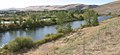
 Yakima river from Prosser.jpg 2,592 × 1,936; 1.62 MB
-
 Yakima River running through Prosser with the Horse Heaven Hills.jpg 2,592 × 1,936; 1.59 MB
-
 Yakima River south of Union Gap.jpg 1,000 × 456; 281 KB
-
 Yakima Sportsman State Park.jpg 8,000 × 6,000; 19.49 MB
-
 Yakima Valley open prairie, ca 1910s (INDOCC 1359).jpg 768 × 616; 95 KB
-
 Yakima Valley.jpg 1,024 × 681; 143 KB
-
 Yakimarivermap.jpg 666 × 676; 599 KB


.jpeg)

.jpg)
.jpg)
.jpg)
.png)

.jpg)
.jpg)
.jpg)
.jpg)
.jpg)
.jpg)
.jpg)
.jpg)
.jpg)
.jpg)
.jpg)
.jpg)
.jpg)
.jpg)
.jpg)
.jpg)
.jpg)
.jpg)
.jpg)


.png)

.jpg)
.jpg)
.jpg)
.jpg)
.jpg)
.jpg)
.jpg)

.jpeg)
.jpg)


.jpg)


.jpg)
.jpg)
.jpg)
.jpg)
.jpg)
.jpg)
.jpg)